
Two storm systems are expected Friday through Sunday, with coastal communities facing rough seas, gusty winds and possible localized flooding.
Sources:
NOAA atmospheric river explanation
https://www.noaa.gov/stories/what-are-atmospheric-rivers
CW3E November outlook
https://cw3e.ucsd.edu/cw3e-ar-outlook-3-november-2026/
SURFSIDE, Wash. — November 12, 2026
The Pacific Northwest is heading into another stretch of wet and windy weather as Pacific storm systems bring renewed rainfall to Washington and Oregon. The first arrives Friday, November 13, followed by another system Saturday night into Sunday, November 15.
For Surfside, Ocean Park and the Long Beach Peninsula, the approaching weather brings several concerns at once: rain, coastal winds, hazardous surf and water collecting on roads and in poorly drained areas. However, current forecasts do not indicate widespread river flooding across the region.
Why atmospheric rivers matter
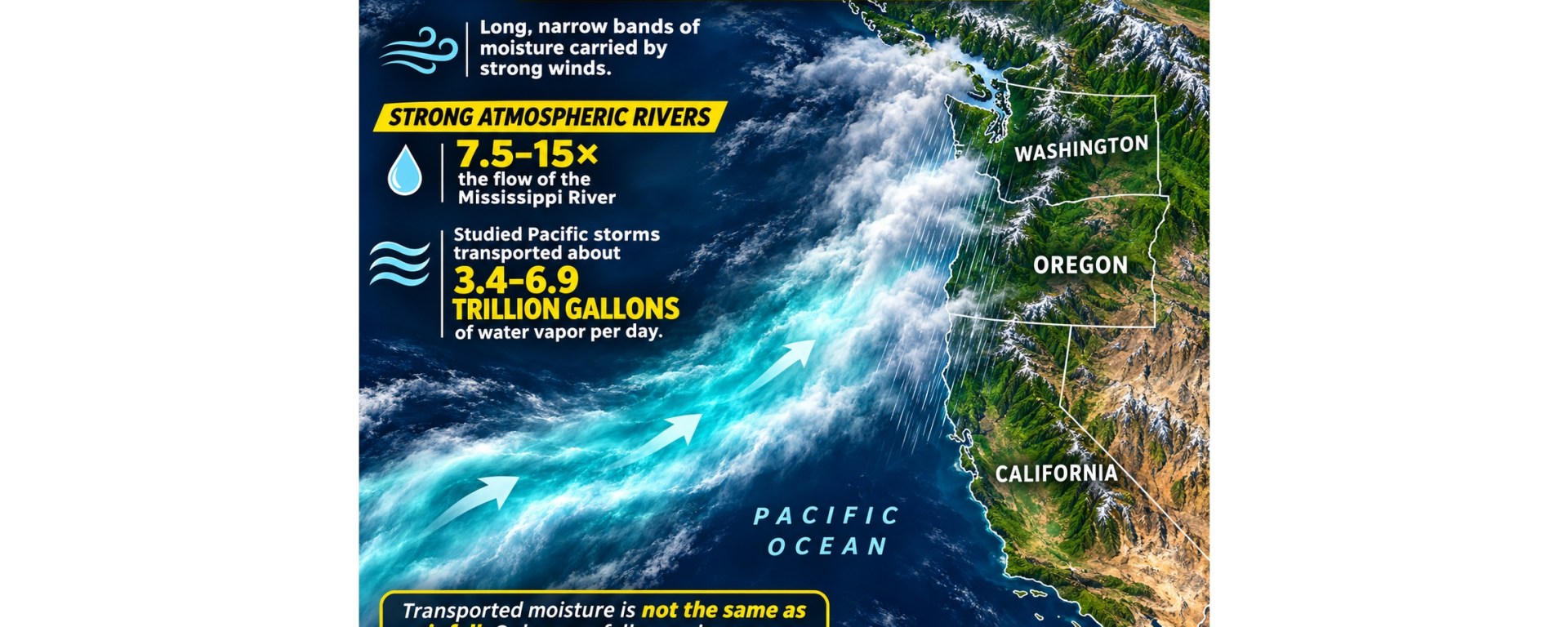
Atmospheric rivers are long, narrow corridors of water vapor carried through the atmosphere. When that moisture reaches land and rises over mountains, it can fall as rain or snow.
They are an essential part of the West Coast’s water supply. Many provide beneficial precipitation, but stronger or persistent events can produce flooding and landslides, particularly when storms repeatedly affect the same watersheds. NOAA emphasizes that the amount of moisture, strength of winds and duration over a location all influence the outcome.
Earlier this month, the Center for Western Weather and Water Extremes identified an increased likelihood of atmospheric river activity during November 9–15. The latest local forecasts now provide a clearer picture of the approaching storm sequence, although rainfall amounts and wind strength still vary by location.
Friday rain, followed by another weekend system
In its Thursday morning forecast, the National Weather Service in Portland expects widespread rain late Thursday night into Friday, with coastal gusts generally reaching 30–40 mph.
A brief easing is possible Saturday before rain returns Saturday night into Sunday. For the second system, forecasters estimate a 60–70% chance of more than an inch of rain in 24 hours along the coast within the Portland forecast area. That probability is substantially lower along the Interstate 5 corridor.
Repeated rainfall could increase runoff and soil saturation. Portland forecasters put the chance of widespread river flooding below 5%, while cautioning that localized flooding of small streams, urban areas and poorly drained roads remains possible.
These are regional probabilities, rather than a guaranteed rainfall total for an individual Peninsula neighborhood.
Source: NWS Portland forecast discussion (https://forecast.weather.gov/product.php?site=PQR&issuedby=PQR&product=AFD&format=CI&version=1&glossary=1), updated 10:22 a.m. PST November 12.
Western Washington faces a stronger second storm
Farther north, NWS Seattle expects the stronger system later Saturday into Saturday night. Its Thursday forecast gives coastal locations a 50–70% chance of gusts reaching 50 mph.
Rainfall from midday Saturday through Sunday afternoon is forecast at approximately 1.5–2 inches along the coast and as much as 3–4 inches in the Olympics.
The Skokomish River is expected to rise above flood stage later Friday into the weekend. Seattle forecasters do not currently expect flooding on other rivers in their forecast area during the next seven days.
Source: NWS Seattle forecast discussion
issued 9:02 a.m. PST November 12.
Dangerous ocean conditions extend through the weekend
NWS Portland’s Thursday briefing identifies hazardous seas and high surf through the weekend, with a 65–80% chance of seas of 20–25 feet Friday evening into Saturday morning and again Sunday evening into Sunday night.
Those figures describe marine seas, not a uniform breaking-wave height at every beach. Local beach conditions and wave runup can differ considerably.
The briefing also identifies possible downed trees and localized power outages along the coast. Residents should check current beach alerts before traveling to exposed shorelines.
Source: NWS Portland weather briefing (https://www.weather.gov/media/pqr/IdssBriefing/NWSPortland_EmailBriefing.pdf), issued 7 a.m. PST November 12.
Prepare before the rain and wind arrive
Secure loose outdoor items and clear leaves from accessible drains and gutters before conditions deteriorate. Charge phones and keep flashlights available.
Never drive around road-closure barriers or enter flooded roads. Water can conceal damaged pavement, and moving floodwater can carry a vehicle away. Follow evacuation instructions if issued.
Forecasts will change as the systems approach. Check NWS Portland https://www.weather.gov/pqr/
southwest Washington and northwest Oregon, NWS Seattle https://www.weather.gov/sew/
For much of western Washington, and official river forecasts https://water.noaa.gov/
for conditions near your community.
Flood safety: National Weather Service — Turn Around, Don’t Drown https://www.weather.gov/safety/flood-turn-around-dont-drown
Forecast information checked November 12, 2026. Rainfall, wind probabilities and alerts may change.

