
SURFSIDE WASHINGTON NEWS | NOVEMBER 13, 2026
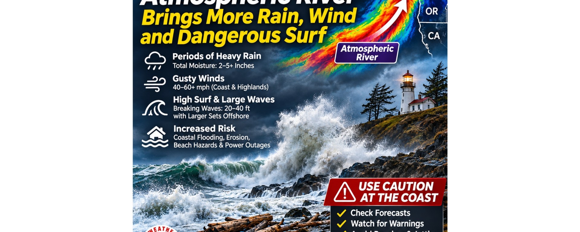
National Weather Service issues two coastal advisories for the South Washington Coast, warning of extreme sneaker waves, tidal flooding, beach erosion and potentially deadly surf conditions near Ocean Park, Surfside and Long Beach. Monitor latest weather at the links at the bottom of the article for latest updates because weather forecasts can change.
Residents and visitors along Washington’s southwest coast are being warned to prepare for dangerous ocean conditions as powerful Pacific swells approach the shoreline Friday, November 13, and continue into Saturday, November 14.
The National Weather Service (NWS) in Portland has issued both a High Surf Advisory and a Coastal Flood Advisory for the South Washington Coast, including the Ocean Park, Surfside and Long Beach areas.
Forecasters warn that breaking waves could reach 30 to 35 feet, creating hazardous conditions along beaches, dunes, jetties and other exposed coastal locations. The advisories also warn of tidal flooding, minor beach erosion and an extreme threat from sneaker waves capable of sweeping people into the ocean without warning.
Coastal Flood Advisory: Friday, November 13, noon–4 p.m. PST.
High Surf Advisory: Friday, November 13, noon through Saturday, November 14, noon PST.
Waves Could Reach 35 Feet Along the Coast
According to the NWS coastal hazard message issued at 12:43 a.m. Friday, powerful waves are expected to strike the southern Washington coastline throughout the advisory period.
Breaking waves reaching 30 to 35 feet can produce tremendous force when they encounter shallow water, beaches, rocks, jetties and coastal structures. These conditions are especially dangerous along the Long Beach Peninsula, where broad sandy beaches, driftwood and relatively low-lying coastal areas attract visitors throughout the year.
Wave heights will vary depending on local beach slope, underwater terrain, swell direction and exposure. Importantly, the forecast 30-to-35-foot breakers do not mean ocean water will rise uniformly 35 feet above the shoreline. Breaking-wave height and coastal flood elevation are different measurements. Nevertheless, individual waves can travel significantly farther inland than expected, especially during high tides.
Extreme Sneaker Wave Danger Friday Evening and Overnight
Perhaps the most serious threat identified by the National Weather Service is the potential for sneaker waves. The agency specifically warns that the sneaker wave threat will be extreme, with the greatest danger expected Friday evening and Friday night.
Sneaker waves are unexpectedly powerful waves that surge much farther up a beach than surrounding waves. They can arrive after several minutes of apparently calmer surf, giving beachgoers a false sense of security. A single large wave can knock a person down, sweep them into deep water and expose them to life-threatening cold-water conditions.
The NWS also warns that large driftwood logs can be lifted and rolled by incoming water. Even a relatively small movement of a heavy, waterlogged log can cause severe injury. People should not approach the shoreline to photograph the waves or attempt to judge a safe distance based on where earlier waves stopped.
Coastal Flooding Expected During Friday Afternoon High Tide
The Coastal Flood Advisory is scheduled for noon through 4 p.m. Friday. The NWS expects minor tidal overflow flooding in low-lying locations near bays, sloughs and the lower reaches of coastal rivers. Floodwater could reach approximately one foot above ground level in susceptible locations.
The agency forecasts the Toke Point tide gauge near Willapa Bay to reach approximately 11.2 feet during Friday afternoon’s high tide. That reading is a forecast gauge water level referenced to its tidal datum, not a prediction that 11.2 feet of water will cover nearby land.
Flooding is most likely where high tides, elevated coastal water levels and local geography combine to push water onto normally dry ground. Areas near Willapa Bay, tidal channels, low-lying roads and waterfront properties should pay particular attention to changing water levels. Residents should avoid driving through flooded roadways and move vulnerable equipment or belongings away from locations that routinely experience tidal overflow.
Why Are the Waves So Large?
Powerful storms over the North Pacific can generate enormous ocean swells that travel hundreds or even thousands of miles before reaching Washington’s coastline. Strong winds blowing across large expanses of ocean transfer energy into the water, generating waves that continue traveling long after they leave the storm system.
When long-period swells reach shallow coastal waters, the waves slow, grow steeper and eventually break. Several factors can increase the resulting coastal hazard: strong offshore storms; long-period waves; high tides; coastal geography concentrating wave energy; and elevated water levels increasing shoreline erosion and tidal overflow.
Although unusually large waves can occur during Pacific Northwest fall and winter storms, their timing and combination with high tides can make individual events particularly dangerous. The current NWS advisory does not establish that El Niño or climate change caused this specific event. Determining those influences would require additional meteorological analysis.
What This Means for Surfside and the Long Beach Peninsula
For residents of Surfside, Ocean Park, Long Beach and surrounding coastal communities, the advisories raise concerns about public safety and shoreline conditions. Beachfront property owners should watch for unusually high wave run-up and localized erosion. Low-lying areas near tidal waterways may experience temporary flooding.
Strong surf can also move sand, reshape beach profiles and deposit driftwood farther inland. Although the NWS identifies the possibility of minor beach erosion and coastal property damage, it does not predict that every beachfront property will experience flooding or erosion. Conditions can differ considerably between locations only a short distance apart.
Residents should also recognize that a High Surf Advisory does not necessarily mean a tsunami is approaching. The current hazard involves storm-generated ocean waves and elevated coastal water levels.
Safety Recommendations for Coastal Residents and Visitors
The National Weather Service urges the public to remain well back from the ocean and avoid exposed coastal structures. During the advisory period:
1. Stay off beaches and jetties where large waves can reach. Do not assume an area is safe because the water appears calm.
2. Avoid driftwood and large logs. Incoming waves can move them suddenly.
3. Keep children and pets away from the shoreline. Sneaker waves can overwhelm people within seconds.
4. Avoid flooded roads. Water may conceal erosion, debris or damaged pavement.
5. Monitor vulnerable coastal properties. Take precautions before high tide, without entering dangerous surf zones.
6. Check updated official forecasts. Advisories may be extended, upgraded or canceled as conditions change.
Residents should also avoid turning their backs on the ocean while watching or photographing storm waves. The safest approach during an extreme sneaker wave threat is to observe the ocean from a secure, elevated location well away from wave run-up.
A Reminder of the Pacific Coast’s Power
Washington’s coastline is accustomed to powerful winter storms, but the combination of 30-to-35-foot breaking waves, extreme sneaker wave danger and tidal overflow flooding deserves particular attention. Even experienced beachgoers can underestimate how quickly ocean conditions change.
Friday evening and overnight are especially concerning because the forecast peak in sneaker wave danger coincides with darkness, making incoming waves more difficult to see. For residents and visitors across the Long Beach Peninsula, this is a time to prioritize safety over sightseeing.
The ocean may provide a spectacular display, but the National Weather Service’s warning is clear: stay well back from the water and do not underestimate the force of incoming waves.
Official Weather and Coastal Information
National Weather Service Portland: https://www.weather.gov/portland
National Weather Service coastal safety: https://www.weather.gov/safety/ripcurrent
NOAA tides and water levels: https://tidesandcurrents.noaa.gov/
NOAA National Data Buoy Center: https://www.ndbc.noaa.gov/
Pacific County Emergency Management: https://www.pacificcountysheriff.com/
Wind monitoring
https://www.windy.com/?45.475,-122.556,5
Surf forecast Surf forecasts with breaking wave heights, swell periods, and conditions at individual beaches
Source: National Weather Service Portland Coastal Hazard Message, issued November 13, 2026, at 12:43 a.m. PST, covering the South Washington Coast (WAZ201). Advisory information reflects that issuance and may change as updated forecasts become available.

