
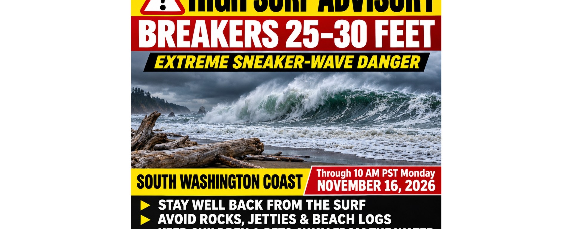
OCEAN PARK, WASHINGTON — November 14, 2026 — Residents and visitors along the South Washington Coast should continue avoiding the surf zone as large breakers and hazardous beach conditions persist through the weekend.
In its 11:58 a.m. Saturday bulletin, the National Weather Service in Portland announced that the High Surf Warning would expire at noon, while a High Surf Advisory remains in effect until 10 a.m. PST Monday, November 16.
The advisory forecasts breakers reaching 25 to 30 feet along the South Washington Coast and Oregon’s north and central coasts. For communities including Surfside, Ocean Park and Long Beach, the change from a warning to an advisory does not mean beaches are safe.
Extreme sneaker-wave threat
The Weather Service describes the sneaker-wave threat during these conditions as extreme. Waves may unexpectedly sweep over beaches, rocks, jetties and other exposed structures, knocking people down and pulling them into the cold Pacific.
A quiet stretch of ocean can create a false sense of security. National Weather Service safety guidance explains that sneaker waves can follow 10 to 20 minutes of smaller waves and surge much farther up the beach than people expect. Cold-water immersion can rapidly impair a person’s ability to escape.
For anyone planning a beach walk, photographing the surf or visiting an ocean overlook, the safest choice is to stay away from areas waves can reach.
Waves can roll heavy beach logs
The advisory also warns people to keep away from large logs. Water rushing up the beach can lift or roll them, potentially crushing anyone caught in their path.
A log that appears firmly settled in the sand can become dangerous when a larger wave arrives. Avoid sitting, standing or climbing on driftwood near the water.
Higher-than-normal wave run-up is also expected along beaches and low-lying shoreline. The bulletin identifies minor beach erosion and possible damage to coastal properties and buildings among the potential impacts.
Take precautions through Monday morning
Residents and visitors should:
- Stay well back from the water’s edge and remain alert for unusually large waves.
- Avoid rocks, jetties and exposed shoreline structures.
- Keep children and pets away from the surf zone.
- Stay clear of large logs and driftwood.
- Watch the ocean continuously and maintain a clear route away from approaching water.
- Check updated forecasts before visiting the coast, because advisory timing and conditions may change.
The advisory’s scheduled expiration is not a guarantee that the ocean will become safe at that hour. Beachgoers should continue assessing conditions and following subsequent Weather Service guidance.
Forecast details are based on the National Weather Service bulletin issued at 11:58 a.m. PST November 14, 2026, reproduced above.
Forecast updates: https://www.weather.gov/portland
Sneaker-wave safety: https://www.weather.gov/safety/sneaker-waves

