
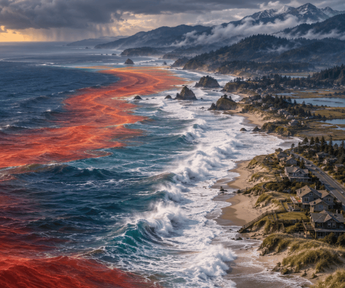
California’s coastline is experiencing a dangerous combination of hurricane-generated waves, unusually high tides, extreme heat and warming ocean water—conditions that may offer an early warning of what could reach Oregon and Washington later this fall and winter.
The remnants of Hurricane Marie, although remaining far offshore, recently sent powerful swells toward Southern California. Waves reached approximately 10 feet in some locations, creating life-threatening rip currents, coastal flooding and damage near beachfront properties.
The event demonstrates an important fact about tropical storms: they do not have to make landfall to cause serious coastal damage.
At the same time, a strengthening El Niño is moving unusually warm water across the Pacific. Scientists are monitoring coastal Kelvin waves that could temporarily elevate sea levels along California before continuing north toward Oregon and Washington.
Hurricane Marie creates dangerous surf
Hurricane Marie generated waves that reached Southern California from hundreds of miles away. The National Weather Service warned of hazardous surf and powerful rip currents, while authorities closed some beachfront parking areas and urged people to remain off jetties and rocks.
Newport Beach lifeguards reportedly conducted 177 rescues in a single day. In Malibu, coastal erosion contributed to damage near a beachfront home, demonstrating how quickly powerful waves can undermine driveways, stairs, decks and foundations. “Associated Press” (https://apnews.com/article/9a57a27e84cc48fefb90c10baa499cfe)
Tropical systems generate long-period swells that can travel far beyond the storm. Unlike short, locally generated waves, these swells carry substantial energy and can surge much farther up a beach when they reach shallow water.
A distant hurricane can therefore threaten coastal homes even when residents experience little wind or rain.
High tides increase flooding around San Francisco Bay
Northern California is also experiencing unusually high coastal water levels. A coastal flood advisory was issued for low-lying areas around San Francisco Bay, San Pablo Bay and Monterey Bay.
Water levels were expected to rise as much as approximately 1.2 feet above normally dry ground in some vulnerable locations, potentially flooding shoreline roads, parking areas and waterfront property.
These conditions do not mean California’s entire coastline has permanently risen by more than a foot. They reflect the temporary combination of tides, ocean conditions, atmospheric pressure and local coastal geography.
Nevertheless, temporary flooding provides a preview of the conditions communities could face more often as long-term sea-level rise continues.
El Niño’s coastal influence is arriving
NOAA declared that El Niño developed in June 2026 and expects it to strengthen through the fall and winter. El Niño occurs when tropical Pacific trade winds weaken or reverse, allowing unusually warm surface water to spread east toward Central and South America.
These changes can generate oceanic Kelvin waves—broad pulses of warm water that travel east along the equator. After reaching the Americas, part of their energy turns north and travels along the coastline as a coastally trapped wave.
These are not breaking waves that people can see or surf. They are large-scale movements of warmer water that can raise the sea surface for weeks or months.
NOAA reports that such waves typically produce measurable coastal sea-level changes of approximately six inches. Scientists are watching for a stronger signal resembling conditions during the powerful 1997–98 El Niño. “NOAA Fisheries” (https://www.fisheries.noaa.gov/feature-story/ocean-indicators-were-tracking-el-ninos-arrival-west-coast)
Reports that California could experience a temporary increase approaching one foot later this fall are based on the amount of elevated warm water moving north from the tropics. The actual increase will vary by location and must be confirmed by satellites and coastal tide gauges.
California’s ocean is already unusually warm
The water off Southern and Central California is already warmer than normal, partly because of a marine heatwave that developed before the current El Niño.
El Niño could intensify that warming by weakening coastal upwelling—the natural process through which winds bring cold, nutrient-rich water to the surface.
This could affect marine ecosystems as well as coastal weather. Reduced upwelling may change plankton productivity, fish distribution and salmon survival. Warm-water species may move north, while marine mammals and seabirds may struggle to find their normal food sources.
Warmer water may also increase the risk of harmful algal blooms, which can lead to shellfish closures and harm marine wildlife.
Beachfront homes face a combination of hazards
The greatest threat to coastal homes occurs when several hazards arrive at the same time.
A tropical storm can send powerful swells toward shore. A Kelvin wave can elevate the underlying water level. King tides can add still more water, while strong onshore winds and low atmospheric pressure push the ocean against the coast.
Heavy rain can simultaneously saturate dunes, increase runoff and prevent stormwater from draining.
For beachfront homeowners, the combined effects may include:
- Rapid loss of beach and dune sand.
- Waves reaching foundations, decks and stairs.
- Undermining of driveways and access roads.
- Damage to seawalls and rock barriers.
- Flooding of garages, crawl spaces and lower floors.
- Saltwater damage to electrical and heating equipment.
- Septic-system failures and rising groundwater.
- Debris, driftwood and logs striking buildings.
- Temporary isolation when roads become flooded or buried by sand.
A few additional inches of water can make an enormous difference. It can determine whether a wave breaks harmlessly on the beach or reaches the dune, roadway or first row of homes.
Long-term sea-level rise reduces the margin of safety
California has experienced approximately eight inches of sea-level rise during the past century. The state’s 2024 guidance projects an additional rise of approximately 0.5 to 1.2 feet by 2050 compared with 2000 levels.
By 2100, California expects approximately 1.6 to 3.1 feet under its central projections, although much greater increases cannot be ruled out. “California Ocean Protection Council” (https://opc.ca.gov/2024/06/for-immediate-release-ocean-protection-council-adopts-updated-guidance-to-help-california-prepare-for-and-adapt-to-rising-seas/)
This long-term rise is different from the temporary increase caused by El Niño. El Niño eventually fades, allowing regional water levels to decline. Climate-driven sea-level rise persists because the ocean expands as it warms and melting glaciers and ice sheets add water.
The danger comes from the interaction between them. Every temporary El Niño, high tide or storm now begins from a gradually rising ocean baseline.
What this could mean for Oregon and Washington
Tropical cyclones rarely reach Oregon or Washington as intact storms, but their swells and moisture can still affect the Pacific Northwest. Coastally trapped Kelvin waves can also continue north along the continent.
NOAA says scientists are watching for El Niño-related ocean changes to spread along the West Coast this fall. The effects generally weaken toward the north, so Oregon and Washington should not assume they will receive the same water-level increase reported in California.
However, strong El Niño events have previously produced higher coastal water levels, larger waves and extensive erosion throughout all three West Coast states.
During the 2015–16 El Niño, researchers examined 29 beaches in California, Oregon and Washington and documented an unusually powerful combination of waves, elevated water and shoreline erosion. “Nature Communications” (https://pmc.ncbi.nlm.nih.gov/articles/PMC5316878/)
The Long Beach Peninsula’s particular vulnerability
The Long Beach Peninsula is exposed to the Pacific Ocean on the west and Willapa Bay on the east. Its homes, roads, drainage systems, canals, wetlands and shallow groundwater are all connected to surrounding coastal water levels.
Oceanfront homes face the most direct danger from waves and dune erosion. But properties farther inland can also experience flooding when higher bay or ocean levels prevent rainwater and groundwater from draining.
Possible effects include:
- Erosion of the frontal dune and beach.
- Water backing up in roadside ditches.
- Rising water in canals and wetlands.
- Standing water on roads and residential properties.
- Saturated yards and crawl spaces.
- Stress on septic systems.
- Saltwater intrusion into wetlands and shallow groundwater.
- Damage or obstruction along emergency routes.
A storm does not need to strike Washington directly for these problems to develop. A distant tropical system could produce large swells while a separate atmospheric system brings rain and strong coastal winds.
Natural coastal defenses deserve protection
California’s experience also demonstrates the limitations of depending entirely on seawalls and rock barriers. These structures may protect an individual building while reflecting wave energy, narrowing the beach or shifting erosion toward neighboring properties.
Beaches, dunes, wetlands, trees and riparian vegetation provide natural protection. Dunes store sand and absorb storm energy. Wetlands hold floodwater. Trees and other vegetation stabilize soil, intercept rain and slow runoff.
Protecting these systems is a public-safety investment. Removing coastal vegetation, narrowing buffers or allowing intensive development in vulnerable areas can reduce the coast’s ability to withstand higher water and stronger storms.
California offers a warning for Washington
The present conditions in California are not being caused by one factor alone. Hurricane Marie generated powerful surf. High tides elevated water around bays and low-lying shorelines. A marine heatwave warmed the ocean, and El Niño is beginning to influence currents, water levels and weather.
The developing Kelvin wave has not permanently raised California’s entire coastline by one foot, and its eventual impact on Oregon and Washington remains uncertain. But the situation illustrates the growing danger of compound coastal events.
El Niño will eventually weaken. Hurricane swells will subside. High tides will fall.
Long-term sea-level rise, however, will continue. As the average ocean becomes higher, future storms and tides will require less additional water to flood roads, erode dunes and reach beachfront homes.
California’s current experience should encourage Pacific County and Washington’s coastal communities to protect dunes and wetlands, improve drainage, evaluate vulnerable roads and infrastructure, and prepare residents for events in which higher seas, storm, tides and waves arrive together.
 Surfside Washington News