
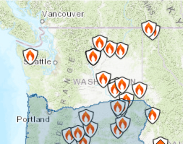
Whether you’re traveling to the Washington coast, the Oregon Cascades, Mount Rainier, the Olympic Peninsula, or anywhere else in the Pacific Northwest, checking wildfire maps before leaving home should be part of every travel plan. Wildfires can quickly affect road conditions, air quality, campground access, and even entire communities.
Conditions can change within hours due to lightning, strong winds, or rapidly growing fires. Spending just a few minutes reviewing official wildfire and travel resources can help you avoid delays, find cleaner air, and make informed decisions before you leave.
1. Northwest Interagency Coordination Center (NWCC)
The Northwest Interagency Coordination Center (NWCC) is one of the best resources for travelers in Washington and Oregon. It provides a regional map of active large wildfires, daily fire reports, weather outlooks, and incident summaries.
Website: https://gacc.nifc.gov/nwcc/
Large Fire Map:
https://experience.arcgis.com/experience/7334974ba06a40c0a3290c732710ae55
The NWCC updates information throughout fire season and provides an excellent overview of wildfire activity across the region.
2. InciWeb Incident Information System
Once you’ve identified a fire on the regional map, InciWeb offers detailed information including:
- Fire size
- Percent containment
- Evacuation notices
- Road closures
- Maps
- Daily incident updates
- Photos
Website: https://inciweb.wildfire.gov/
Washington incidents: https://inciweb.wildfire.gov/state/washington
Oregon incidents: https://inciweb.wildfire.gov/state/oregon
InciWeb is maintained by wildfire incident management teams and is one of the most reliable public sources for major wildfire information.
3. AirNow Fire and Smoke Map
Even if your destination isn’t near an active wildfire, smoke can travel hundreds of miles. The AirNow Fire and Smoke Map combines EPA air-quality monitors with wildfire locations and satellite smoke plumes.
Website: https://fire.airnow.gov/
The map displays:
- Current Air Quality Index (AQI)
- Wildfire locations
- Smoke plumes
- Smoke forecasts
- Health recommendations
This is especially valuable for older adults, children, and people with asthma, COPD, or heart disease.
4. Washington State Department of Transportation (WSDOT)
Before driving across Washington, check for:
- Highway closures
- Construction
- Mountain pass conditions
- Traffic cameras
- Real-time travel alerts
Website: https://wsdot.com/travel/
5. Oregon TripCheck
Travelers in Oregon should always review TripCheck before heading out.
Website: https://tripcheck.com/
TripCheck includes:
- Road closures
- Highway cameras
- Construction zones
- Wildfire impacts
- Weather conditions
6. National Weather Service
Fire danger can increase rapidly when strong winds, hot temperatures, and dry conditions combine. The National Weather Service issues Red Flag Warnings, excessive heat alerts, and lightning forecasts that may indicate elevated wildfire risk.
Website: https://www.weather.gov/
Tips Before You Leave
Before every trip, check:
- Active wildfire locations
- Air quality forecasts
- Highway closures
- Weather forecasts
- Campground or park alerts
- Alternate travel routes
If traveling into remote areas, download maps before leaving since cellular coverage may be limited.
Smoke Can Reach the Coast
Many people assume coastal communities are unaffected by wildfires because they are far from the flames. In reality, upper-level winds can transport smoke hundreds or even thousands of miles, causing poor air quality far from the fire itself. Checking smoke forecasts before traveling to the coast can help protect your health and prevent unpleasant surprises.
Stay Informed and Travel Safely
Wildfire season has become an annual part of life in the Pacific Northwest. Making wildfire maps part of your travel planning can help you avoid dangerous conditions, reduce delays, and enjoy a safer trip. A few minutes of preparation before leaving home can make a significant difference for you, your family, and your travel experience.
 Surfside Washington News