
The 2026 hurricane season has produced a remarkable contrast between America’s two coasts. While exceptionally powerful hurricanes have churned across the eastern Pacific, the Atlantic Basin had not produced a single hurricane as of September 24—even though the statistical peak of the season has already passed.
This does not yet mean 2026 will finish with no Atlantic hurricanes. The official season continues through November 30, and late-season storms remain possible. But the delay has already set a modern record for the latest first Atlantic hurricane of the satellite era. The Atlantic has produced named tropical storms, including Fay, but none has reached the 74-mph threshold required to become a hurricane.
The leading explanation is El Niño: a warming of the central and eastern tropical Pacific that reorganizes weather patterns far beyond the Pacific Ocean.
Why El Niño Can Silence the Atlantic
Hurricanes need more than warm seawater. They also require moist air, rising motion and relatively light winds through the depth of the atmosphere. El Niño changes that atmospheric environment.
Thunderstorms over the unusually warm tropical Pacific strengthen high-altitude winds that extend eastward over the Caribbean and tropical Atlantic. Those winds increase vertical wind shear—a change in wind speed or direction with height. Strong shear can tilt a developing storm, blow its thunderstorms away from its low-level center and prevent it from building the vertically aligned circulation needed to become a hurricane.
El Niño can also promote sinking, drier air over parts of the tropical Atlantic. Warm ocean water may still be present, but the atmosphere above it becomes hostile to storm formation. NOAA says this combination generally reduces Atlantic hurricane activity while making the eastern and central Pacific more favorable for hurricanes.
That helps explain 2026’s extraordinary split: a highly active Pacific and an Atlantic with tropical storms but, so far, no hurricanes.
What It Could Mean for the East Coast
Fewer Atlantic hurricanes substantially reduce the immediate odds of a destructive tropical landfall, but they do not guarantee quiet weather along the East Coast.
El Niño’s strongest and most consistent U.S. effects usually emerge during the cool season, from late fall through winter. It often shifts the Pacific jet stream southward and creates a more active southern storm track. For the Southeast—including Florida, Georgia and the Carolinas—this generally tilts the odds toward a cooler, cloudier and wetter winter.
For coastal communities, the main concerns may change rather than disappear:
More frequent heavy-rain systems: Storms moving along the southern jet can draw Gulf and Atlantic moisture into the Southeast.
Coastal flooding:
NOAA notes that El Niño can steer more storms toward the Mid-Atlantic, increasing opportunities for storm surge and high-tide flooding even without a tropical cyclone.
Nor’easters:
When southern-stream energy meets cold northern air near the East Coast, a strong coastal storm can form. El Niño cannot predict any particular nor’easter, but an active southern storm track can supply moisture and energy for these systems.
Sharp temperature swings: Seasonal averages do not prevent short outbreaks of freezing air, ice or snow. The exact outcome depends on whether cold air is in place when a moisture-rich storm arrives.
The Northeast’s response is less uniform than the Southeast’s. Some El Niño winters are mild, while others produce memorable snowstorms. The storm track, strength of atmospheric blocking near Greenland and timing of Arctic air ultimately determine whether coastal cities receive rain, snow or a damaging mixture.
Atlanta and the Southeast
For Atlanta, El Niño does not necessarily mean a severe winter, but it raises the likelihood of wetter-than-normal conditions across the Southeast. Repeated rain events could ease drought where deficits exist, while also increasing the risk of saturated ground, flash flooding and downed trees during windy storms.
Temperatures in the Southeast often lean cooler than normal during El Niño winters because of increased clouds, rainfall and the southern storm track. Atlanta’s greatest winter-weather hazard may be ice rather than deep snow. If shallow freezing air becomes trapped near the ground while warmer, moisture-laden air flows overhead, freezing rain or sleet can disrupt roads, power and air travel.
These are shifts in probability, not promises. El Niño is one major influence among many, and local forecasts become much more reliable only days before an event.
What About Atlantic Currents and the Gulf Stream?
El Niño primarily influences the East Coast through the atmosphere, especially the jet stream and storm tracks. It should not be described as stopping, reversing or directly weakening the Gulf Stream.
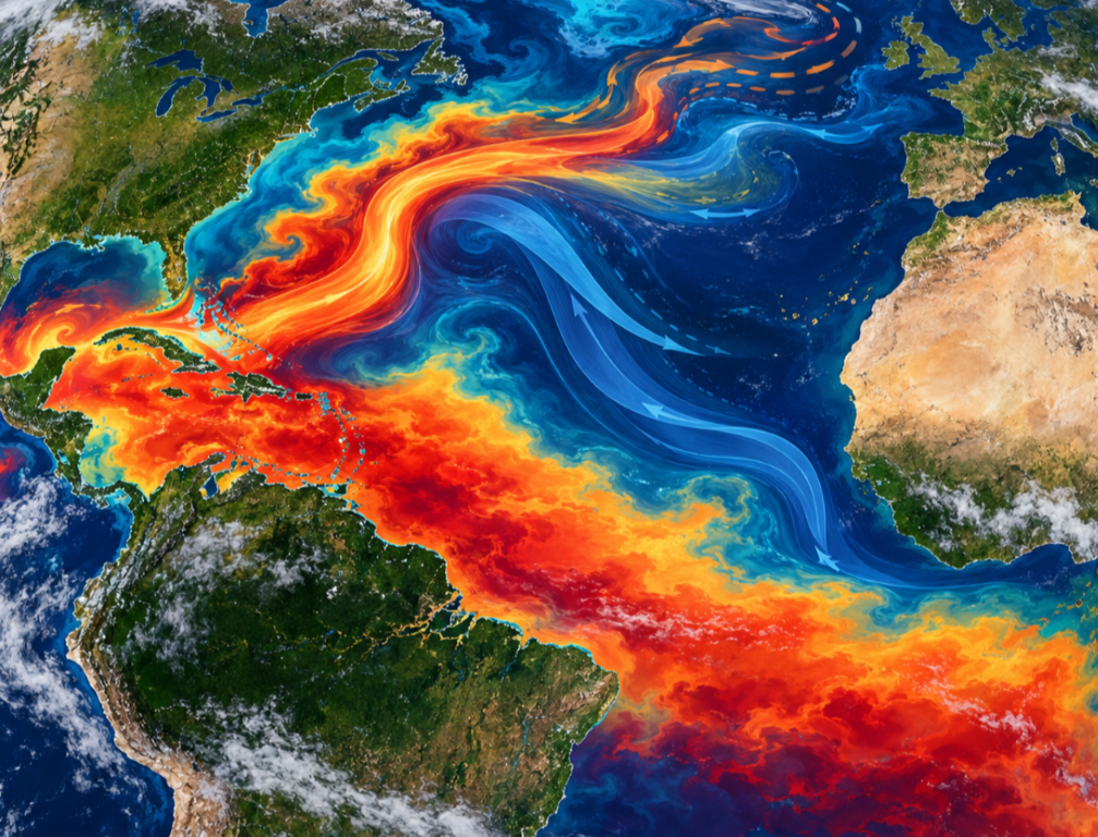
The Gulf Stream is a powerful current carrying warm water northward along the East Coast before turning toward the North Atlantic. Its warm water supplies heat and moisture that can intensify coastal storms when cold continental air moves offshore. This strong temperature contrast helps make the waters near the Gulf Stream a favored development zone for nor’easters.
The relationship can work in the other direction as well: storms temporarily affect the ocean. Hurricanes stir the upper ocean and bring cooler water to the surface, leaving a “cold wake.” With no Atlantic hurricanes so far this year, there has been less hurricane-driven mixing along storm tracks. That could allow some surface areas to retain more warmth, but this is a localized, temporary effect—not evidence that El Niño has fundamentally changed the Gulf Stream or the larger Atlantic circulation.
Scientists carefully distinguish the Gulf Stream from the broader Atlantic Meridional Overturning Circulation, or AMOC. Both are important, but neither should be blamed for this year’s hurricane absence without direct measurements and evidence.
A Record Lull Is Not an All-Clear
The quiet Atlantic is good news for coastal residents, insurers and emergency managers, particularly after years of destructive storms. But “no hurricanes yet” is not the same as “no danger.” Warm coastal waters can support storms that develop close to land, where warning time is short, and ordinary tropical storms can still cause deadly flooding.
Nor does one quiet Atlantic season contradict long-term ocean warming. Hurricane activity depends on the complete ocean-atmosphere system. In 2026, strong El Niño-related wind shear appears to have overwhelmed the fuel provided by warm Atlantic water. When El Niño fades, that atmospheric protection may fade with it while the underlying warm water remains.
The larger lesson is that weather risks can migrate. El Niño may suppress Atlantic hurricanes while energizing the Pacific and setting up a wetter, stormier cool season across parts of the South and East. East Coast residents may face fewer tropical threats this year—but potentially more rain, coastal flooding, nor’easters and disruptive winter weather in the months ahead.
Sources
NOAA Atlantic Oceanographic and Meteorological Laboratory, “How Does El Niño Impact Atlantic Hurricane Season?” https://www.aoml.noaa.gov/how-does-el-nino-impact-atlantic-hurricane-season/
NOAA Climate Prediction Center, “ENSO Diagnostic Discussion.” https://www.cpc.ncep.noaa.gov/products/analysis_monitoring/enso_advisory/ensodisc.shtml
NOAA Ocean Service, “What Are El Niño and La Niña?” https://oceanservice.noaa.gov/facts/ninonina.html
NOAA Ocean Service, “El Niño and High Tide Flooding, a Possible Double Whammy.” https://oceanservice.noaa.gov/news/may26/el-nino-flooding.html
NOAA NESDIS, “What Is a Nor’easter?” https://www.nesdis.noaa.gov/about/k-12-education/severe-weather/what-noreaster
NOAA NESDIS, “What Is the Gulf Stream?” https://www.nesdis.noaa.gov/about/k-12-education/oceans-coasts/what-the-gulf-stream
NOAA AOML, “Scientists Observe Rainfall Under Tropical Cyclones and its Response to Sea Surface Temperature.” https://www.aoml.noaa.gov/rainfall-under-tropical-cyclones/

